|
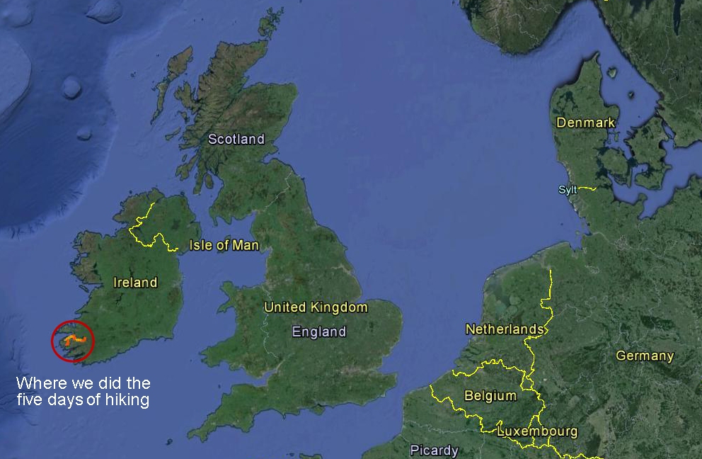
Ireland is roughly the size of Indiana.
We flew from Boston to Dublin (mid-way down the eastern
side of the country), then caught a connecting flight back to Kerry
Airport, just outside of Killarney to begin our walking tour. |
 |
|
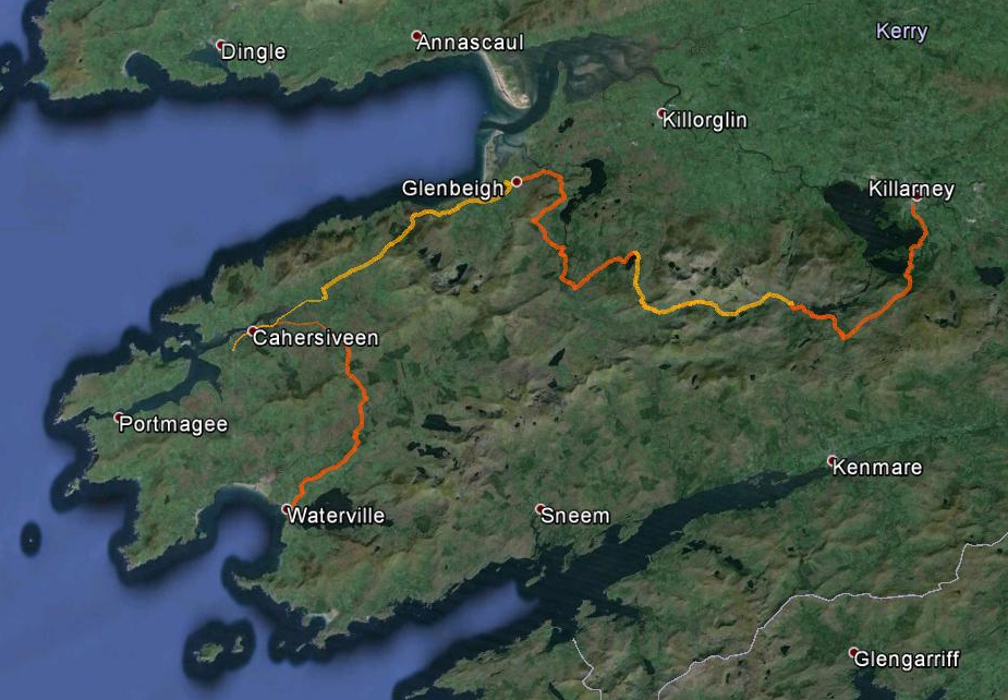
This shows our 5 days of hiking, in alternating orange
and yellow paths. We started in Killarney and finished in
Waterville.
I took a GPS with me for the hike, and then brought the
tracks into Google Earth to help make these maps. If you're
interested, feel free to download the *.kmz
file here. |
 |
|
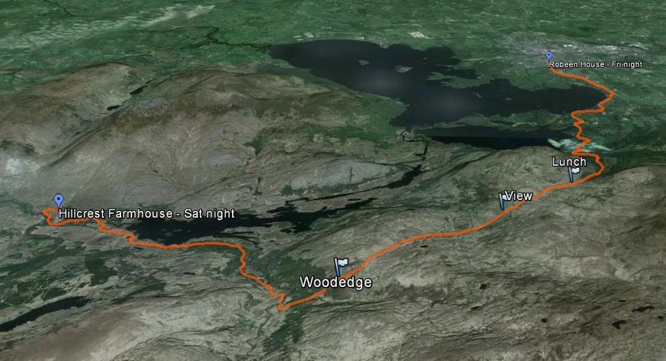
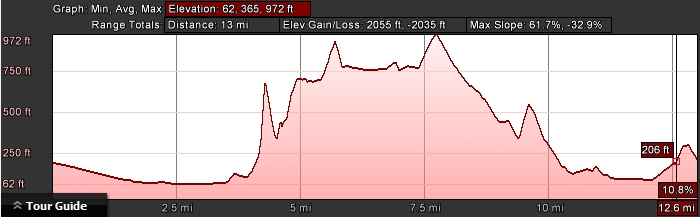
The first day brought us from the Robeen House in
Killarney down to the Hillcrest Farmhouse.
It was about a 13 mile hike. |
 |
|
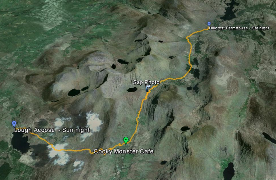
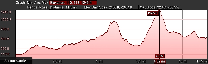
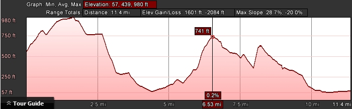
Here's the 2nd day... hands down the most challenging
of the trip.
Even though the total distance was only about 11.5
miles, we had two pretty significant gaps/hills to get over. |
 |
|
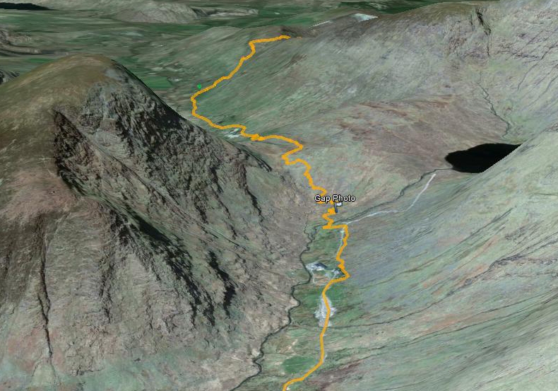
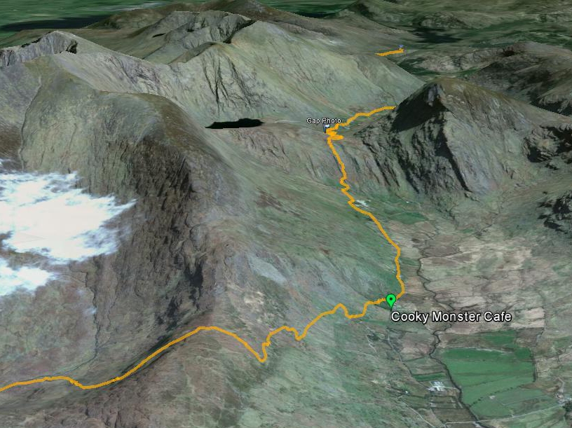
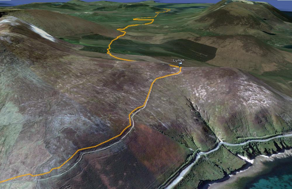
This is another perspective, showing the scale of the
big mountain that was on the left side of the gap we crossed.
The tiny green dot in the distance is the Cookie
Monster Cafe, where we had lunch.
In this view, the bottom of the yellow line is about
3.2 miles from the Cafe. |
 |
|
Here's looking back on along the path of day 2. |
 |
|
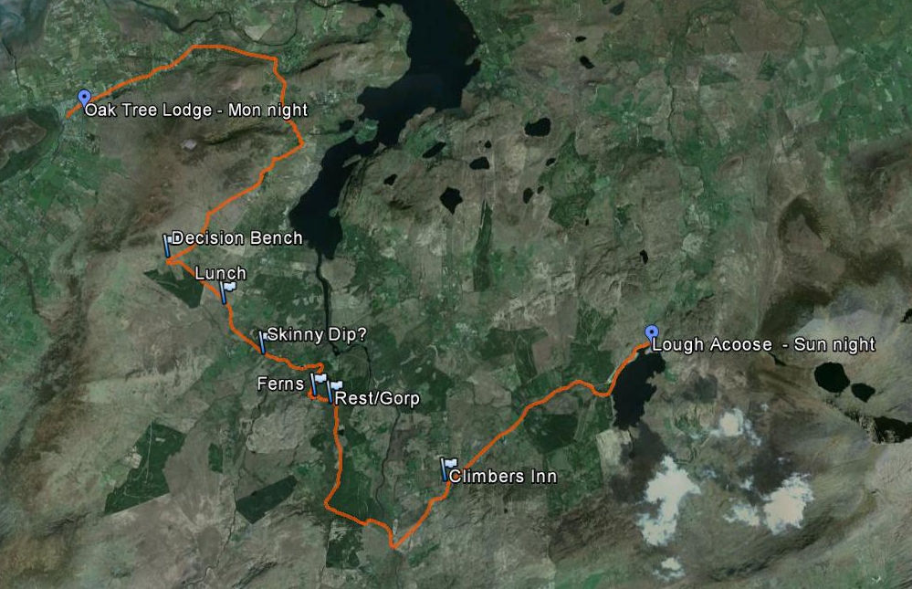
Day 3, from Lough Acoose to the Oak Tree Lodge in
Glenbeigh.
The flag for "Skinny Dip" was where we happened upon a
family splashing around in a stream, and (apparently) caught them by
surprise. :-)
At "Decision Bench", we had a choice of whether we
wanted to go up & over Windy Gap, or take the 4km longer route around.
It was a coin toss, but we're happy with the way we went. |
 |
|
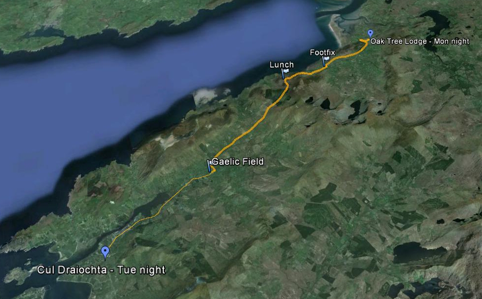
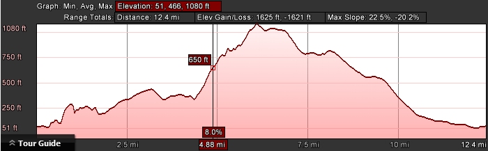
Day 4 brought us from Glenbeigh (upper right) to
Cahersiveen (lower right).
The actual hike finished outside town at a Gaelic
Football field, where we were picked up by Ian from the Cul Draiochta. |
 |
|
Here's just another perspective of day 4's hike up and
around Drung Hill. The panorama page
shows what some of the views were like. |
 |
|
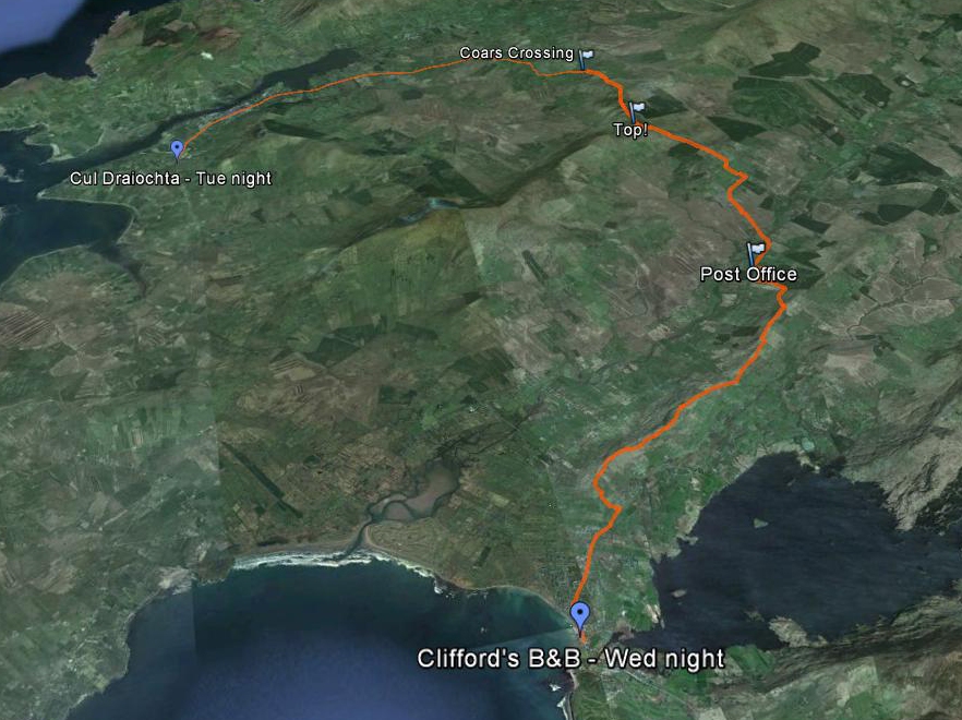
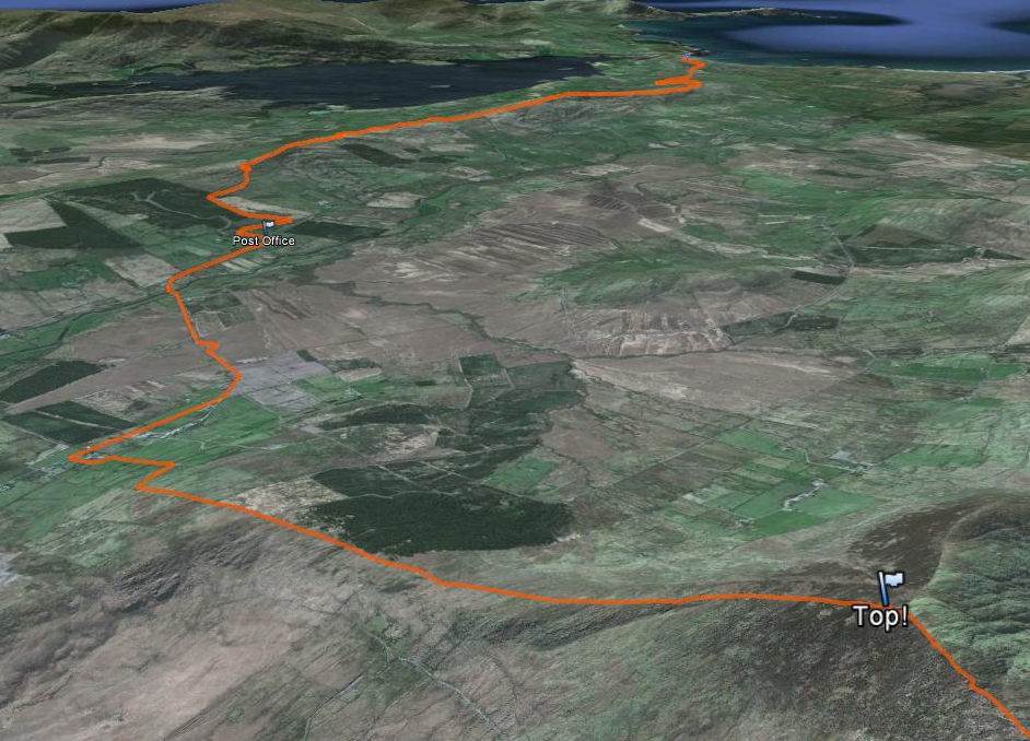
After Ian drove us to Coars Crossing, we had two long
ridge lines to hike before ending up at Cliffords in Waterville. |
 |
| |
 |